
Mancetter
What is it?
Remains of a Roman posting station (burgus) and settlement on the Watling Street in North Warwickshire.
Maps
Ordnance Survey
Landranger - Map 139
Explorer - Map 219
Grid reference - SO984784
Sat Nav - Nearby postcode – CV9 1NJ
Parking - On the roadside by St Peter’s church, junction of Mancetter Road and Quarry Lane. There is also a church car park.
Public transport – Buses from Atherstone, Nuneaton and Coventry stop near Mancetter church see https://www.stagecoachbus.com Nearest railway station at Atherstone (connections from Tamworth and Nuneaton) http://www.nationalrail.co.uk/posters/ATH.pdf which is 2.5km walk from St Peter’s church (via Long Street and Church Walk) or catch the bus.
Access - The visible remains of the burgus lie in farmland and to the rear of the Bull Inn.
There a several public footpaths in the area. Following wet weather some of the paths near the river may be flooded. There are main roads which should be crossed with extreme caution.
There are facilities and places to eat in Atherstone as well as the public house on the burgus site.

What you can see
The Roman remains at Mancetter include buried and earthwork remains of a Roman villa, a fortified settlement (burgus) on Watling Street and an industrial complex located close to the river Anker. There was also a Roman fort, the remains of which lie beneath the area close to St Peter’s church.
The suggested route mainly follows public footpaths and you will also find several interpretation panels which give more information about the sites that were erected by the Atherstone Civic Society.

From The Green, near to St Peter’s Church, cross the road (to the cemetery side) and turn downhill into Mill Lane. At the Scout Hall on your left you will find an interpretation panel which gives information about the finds made during excavations before the construction of the building and another panel, high up on the wall to your right, about the fort. At this point you are standing at the main entrance leading from the Roman fortress which was built on high ground overlooking the river Anker in 49AD shortly after the conquest.

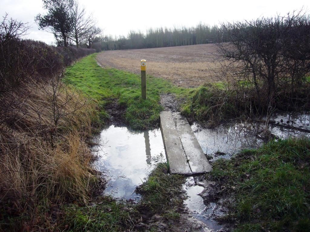
Continue along the lane and cross a watercourse which was the leat feeding a watermill on your left as you cross the first bridge.

Then continue through a kissing gate and over a boardwalk bridge over the river Anker.
This was a ford point during medieval times and was probably always the favoured crossing point back to Roman times and maybe even earlier.

On the other side of the river you will find a second interpretation panel containing information about the Roman pottery industry. Although Mancetter had military origins as a fort the area soon developed into a major pottery making area specialising in the production of ‘mortaria’ (mixing bowls) which have been found in excavations as far away as North Wales and Scotland.
We know this because the potters who worked here stamped their names into the wet clay of the pots before they were fired. Raw materials and finished products would have been transported along the Watling Street and the River Anker.

Follow the footpath ahead keeping the hedge to your left until it curves to the right and you cross into the next field.

This field was the location of about 70 pottery kilns in use from the mid-third through to the fourth century and has been the site of several archaeological excavations in the 20th century.
Continue along the footpath once again keeping the hedge to your left until you reach the next field.

In this field you will see a farm track in front of you.
Look closely and you will see that it runs along a slightly raised ridge of high ground.
This is the south-west side of the burgus, a fortified enclosure constructed in the late third or early fourth century AD. The Mancetter burgus is the most visible and accessible of a group of these sites built by the Romans along the Watling Street to the west and south east.

The area between the track and the hedge contains medieval ridge and furrow but in Roman times contained several, probably official, buildings. A substantial stone wall once enclosed the site, about 3.5 ha in extent, and a series of external ditches provided further protection.
To your left the track turns towards the road and this is the corner of the burgus. Looking across the field and to the right along the fence you can see where the ground rises and this marks the extent of the rampart to the east.

Follow the track towards the road then turn left and walk along the verge.
This is a very busy road so don’t try to cross opposite the public house.
(If you are in a car you may choose to visit the next area separately rather than cross the road here.)
In the field to your left remains of a large Roman villa have been found by the Atherstone Archaeological Society. Excavations in the gardens of the houses on the opposite side of the road have revealed remains of Roman houses shops and a medical surgery. Cross the road when you reach where there is a central reservation – carefully!

Walk towards the public house and take the gate through into the garden behind. (You are now in Leicestershire!) There is another interpretation panel here with information about the 'Burgi' that were constructed along the Watling Street in the late 3rd century AD. The boundary of the garden behind the public house is bounded by the well preserved north-east side of the ramparts, and continues into the paddock beyond. Here you can clearly see the substantial ditch of the Burgus.

Return to the road and, crossing with caution, retrace the route entering the field with the farm track seen earlier and follow it as it curves to the left noting as you cross the rampart where the ground rises. Continue along the track and when it turns to the right heading towards the farm continue straight on along the footpath along the side of the hedge and cross a stream into the next field.
The high ground in the distance beyond the farm to your right is Hartshill where many Roman pottery kilns have been found.
Quarrying also took place here in Roman times and this may have been the source of grit used in the manufacture of the mortaria made at Mancetter.

At the next field boundary follow a permissive footpath (marked DEFRA conservation walks).

The path curves round to the right towards the river. Continue on the riverside path until you get back to the footbridge you crossed earlier. The Anker was an important waterway in Roman times and here at Mancetter there was probably a ferry crossing and a small river port used by the military and for the pottery trade. Cross back over the river and retrace your steps back to the church.
The site is a scheduled monument which means it is protected by law.This means metal detecting and unauthorised digging at the site is not allowed.
Nothing can be seen of the Roman fort that once occupied this area where the village now stands but there is another interpretation panel. Walk north along the Mancetter Road past the churchyard and past the next building (a former public house) and the panel is on the left before the junction.
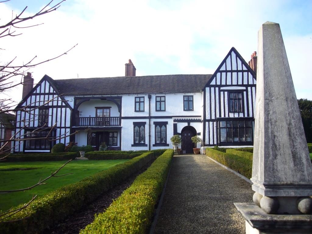
St Peters Church is normally open and Mancetter Manor, a timber framed house dating back to the 13th century, can be glimpsed through the gates overlooking The Green - no public access.
The Atherstone Civic Society as installed several interpretation panels about Roman Mancetter in the area and has produced a walking trail leaflet and a book. http://atherstonecivicsociety.co.uk/projectrm/
Refs:
Burnham, B C & Wacher, J The Small Towns of Roman Britain (1990)
Baddeley, C, Roman Mancetter. Atherstone Civic Society (2013)
Links: http://historicengland.org.uk/listing/the-list/list-entry/1005736
http://timetrail.warwickshire.gov.uk/searchSimple.aspx
Search under Mancetter parish